Before and After: Roehampton #1
A personal hobby of mine, and a pastime I am particularly interested in, is exploring the hidden layers of local history. There is something uniquely rewarding about uncovering how a familiar landscape has evolved over decades, or even centuries, and seeing the traces of the past that still linger in the present.
In this post, I will be showing some before and after comparisons of Roehampton, the area where I grew up. By matching archival photographs with modern-day views, we can trace the transformation of the village from a quiet Victorian hub into a bustling London suburb, uncovering everything from “lost” industrial landmarks to forgotten coaching roads hidden in plain sight.
The Victorian Filling Station: From Social Hub to Stranded Relic
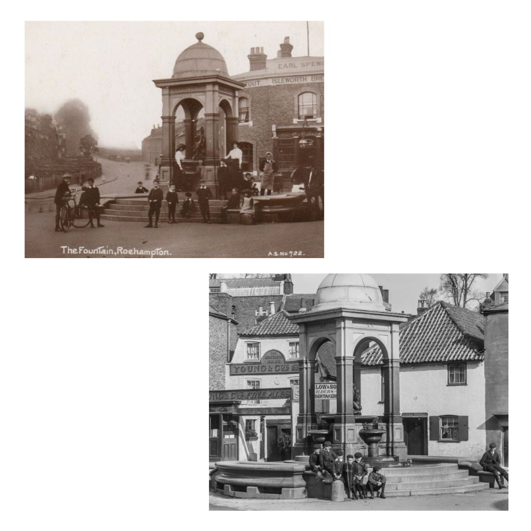
Starting at the heart of the old Roehampton Town, the Victorian Filling Station is a Grade-2 listed fountain designed in 1882 by J.C. Radford and erected by Mrs. Lyne Stephens of Grove House 1. At the time it was built, Roehampton Lane was a major route for horse-drawn traffic. This fountain, like others established by the Metropolitan Drinking Fountain and Cattle Trough Association, acted as a “filling station” for horses pulling heavy carriages or omnibuses up the steep incline towards Putney Heath.
Sadly, much of the original character of the structure’s base has been lost over time. While historical images show the fountain sitting proudly on a series of granite steps, these foundations are no longer visible, having been “swallowed” by successive layers of road resurfacing and modern pavement creep. This gradual rise in the street level has buried the lower architectural details, masking the true scale of the platform that once separated the monument from the dirt and gravel roads of the 19th century.
Directly behind the fountain stands The Earl Spencer (formerly The Spencer Arms), another Grade-2 listed pub that has served as a cornerstone of the village for over a century. Named after the Earls Spencer, who were the historic Lords of the Manor of Wimbledon and Roehampton, the building is a classic example of a Victorian public house. In the horse-and-carriage era, it formed a perfect partnership with the neighboring fountain: while horses were watered at the granite trough, their drivers would stop at the pub for their own refreshment. Today, the building remains remarkably well-preserved, standing as a direct link to Roehampton’s aristocratic past even as the surrounding roads have modernized.
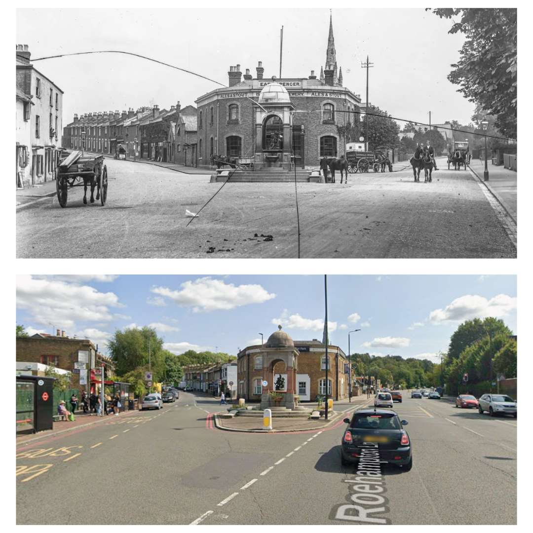
It is clear that this spot once served as a genuine social heart for the village, where residents could safely gather and children could play. In the early 20th century, the junction functioned more like a quiet village square; the slower pace of horse-drawn traffic allowed the fountain to act as both a practical utility and a natural communal meeting point. Today, that sense of a shared “hangout” has largely vanished, replaced by the constant flow of cars and the widening of Roehampton Lane. The fountain now stands isolated on a narrow strip of pavement—a stranded relic of a livelier pedestrian past that most people now only glimpse through a car window as they drive by.
Noel Bell Ltd. and the Holy Trinity Church
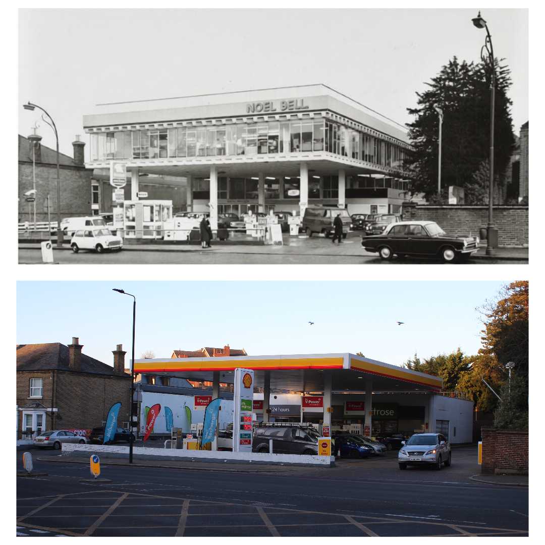
Walking further up Roehampton Lane, I captured this view looking toward the Shell station, but the historical version from the ’60s or ’70s tells a different story. Back then, the site was home to Noel Bell Ltd., a well-known West London car dealer. The most surprising part is the elevated showroom you can see in the old photo—a complete departure from the Shell and Waitrose that stand there today.
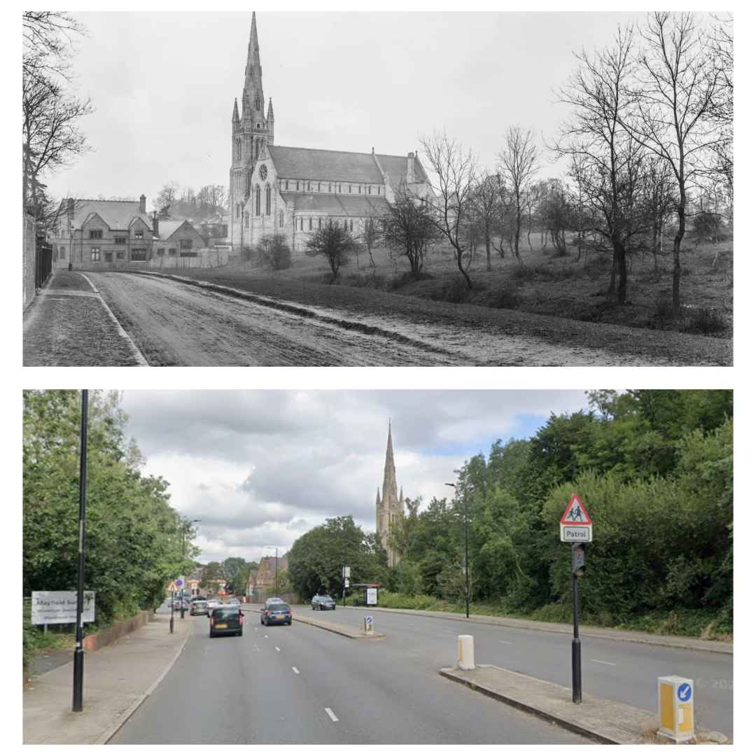
Right next to the Shell fuel station is the Holy Trinity Church a Grade-2* listed building that was designed by Benjamin Ferrey and consecrated in 1898 2. The vintage photograph shows the church and its stone spire as a central landmark on what was then a rural, unpaved road. The original flint-faced vicarage is visible to the left, while the land to the right is open green space. In the modern image, the road has been upgraded to a paved road with traffic islands and bus stops. The church itself is now partially obscured by mature trees and is surrounded by the modern infrastructure of the Alton Estate.
From Spark Plugs to Superstore
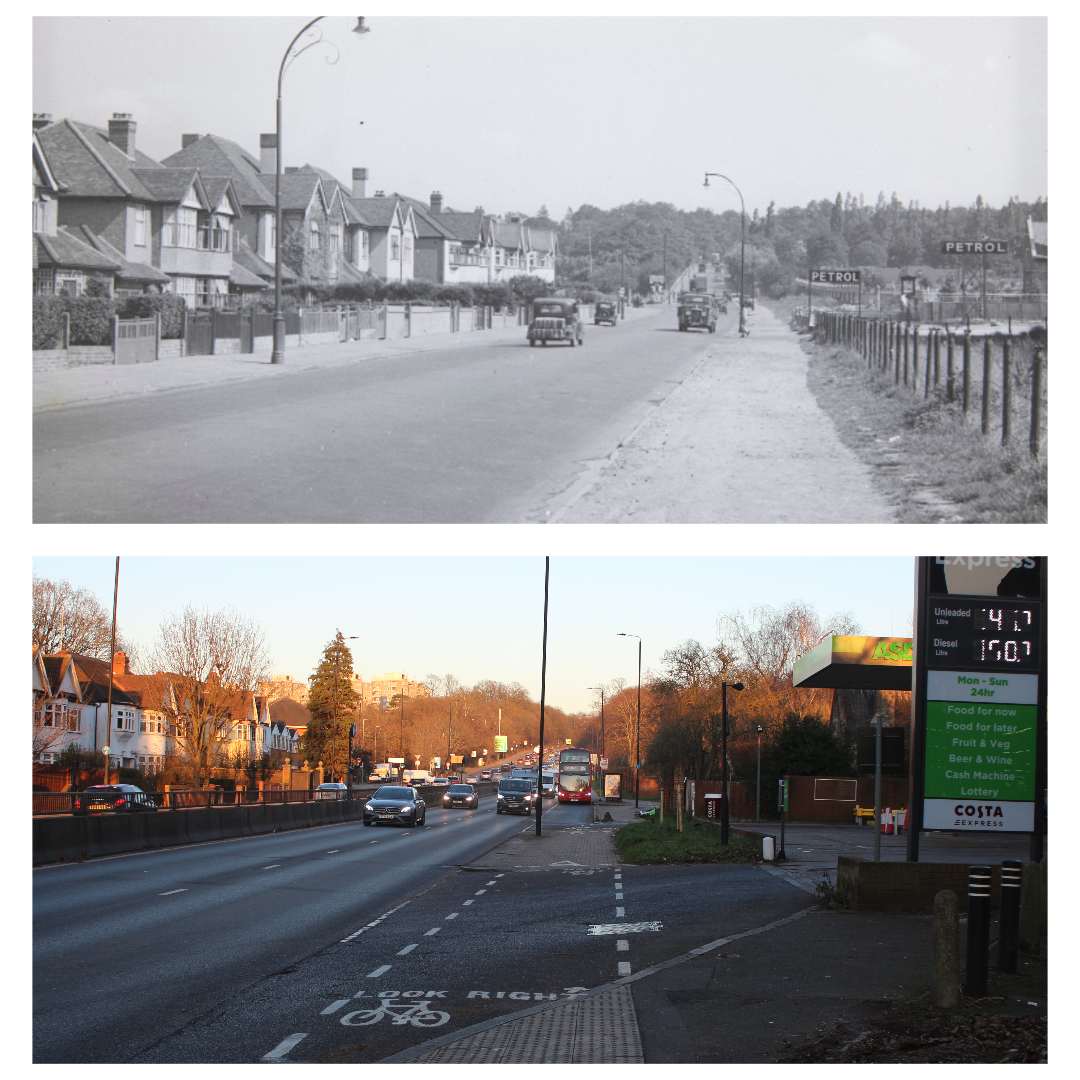
Moving further on Roehampton Lane and then travelling down along Kingston Road (A3) highlights the dramatic transition of this arterial route from a suburban lane into a busy dual carriageway. In the mid-20th century, the road was a simpler, single-carriageway route lined with residential semi-detached houses and a basic petrol station. While the homes on the left have remained a constant through the decades, the right side of the road has seen significant developments. The modern perspective also reveals the addition of the Alton Estate high-rises in the distance and significant infrastructure upgrades, including dedicated bus and cycle lanes, reflecting the massive increase in traffic volume since the 1940s and 50s.
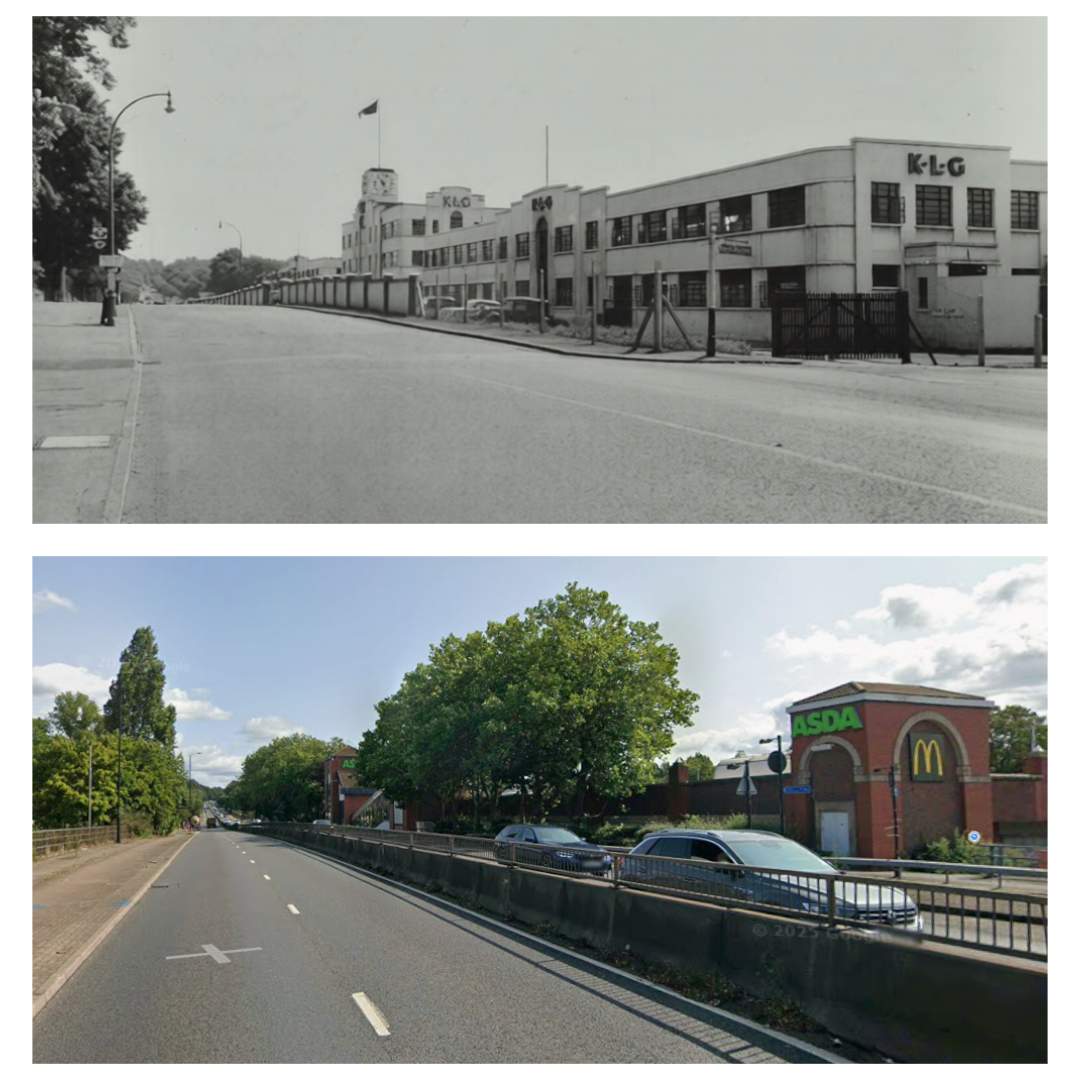
Walking further down, we reach the Asda supermarket; however, past photos reveal that during the mid-20th century, this was actually the location of the K.L.G. Sparking Plugs factory. This striking Art Deco structure was founded by Kenelm (Bill) Edward Lee Guinness (14 August 1887-10 April 1937), a member of the famous Guinness brewing family and a celebrated racing driver throughout the 1910’s and 1920’s 3. Guinness originally began manufacturing his own spark plugs to meet the high-performance demands of his racing career, leading to the establishment of the Roehampton site.
The factory later became a vital local employer and a key contributor to the war effort, producing essential components for aircraft like the Spitfire. Following the factory’s closure and subsequent demolition in 1989, the site was repurposed for the large-scale retail development that houses Asda and McDonald’s today. This transition was accompanied by a massive expansion of the road itself; what was once a simpler route passing a prestigious industrial landmark was widened in the 1960s into the high-capacity dual carriageway seen today.
The “Hidden” Portsmouth Road (A3210)
During my regular walks through the area, I discovered a curious piece of local geography that many people likely overlook. The overhead view below highlights a forested footpath connecting Portsmouth Road and Norstead Place, with both ends of the path terminating in abrupt, unexplained dead ends.
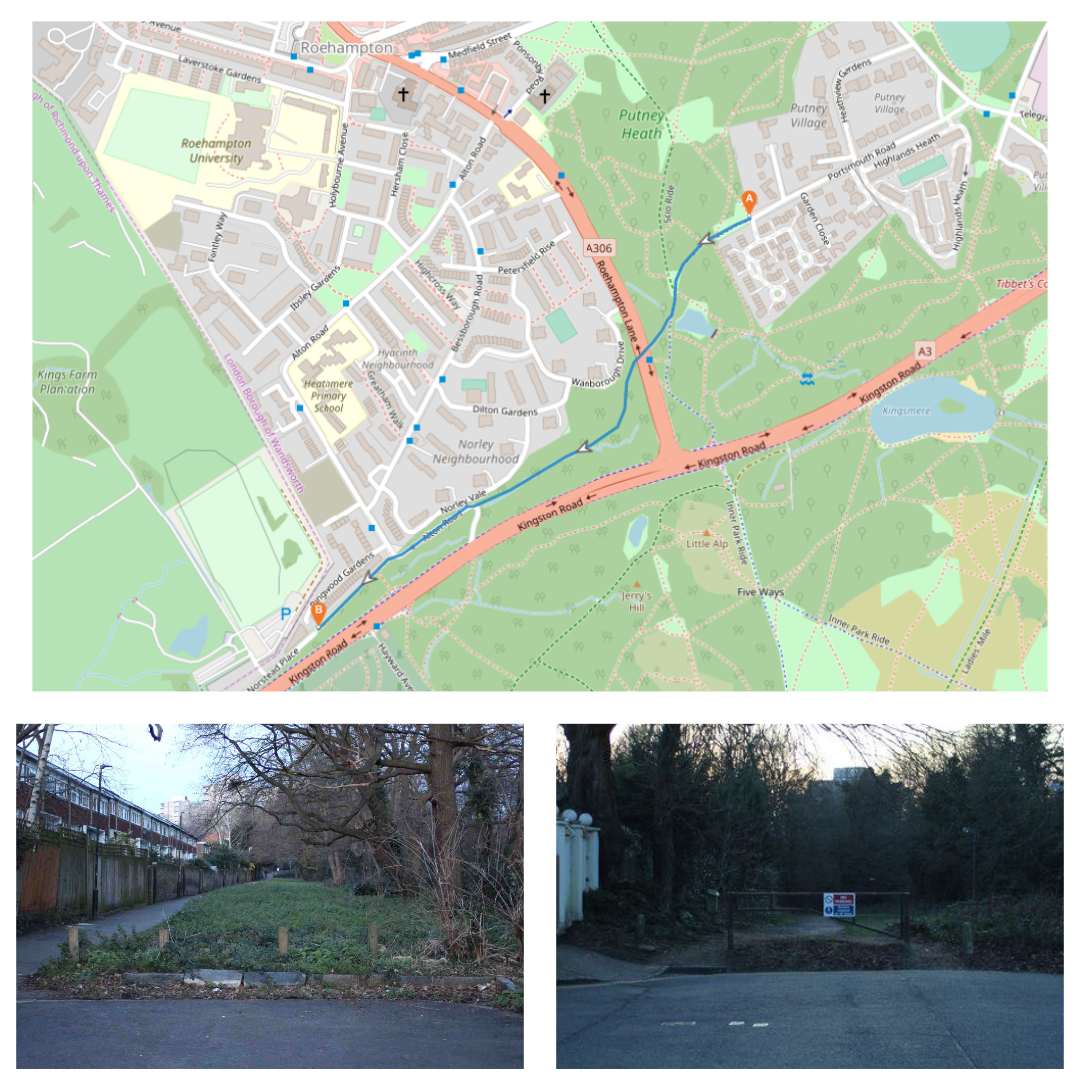
Upon closer inspection, the path contains several out-of-place lamp posts–a subtle clue that this trail was once a functional roadway. As the images below demonstrate, these remnants of urban infrastructure sit strangely within the overgrowth between Portsmouth Road and the modern Roehampton Lane.
It turns out that these sudden dead ends and misplaced lamp posts are physical clues to a long-disused road. I was surprised to discover that this quiet path was originally a segment of the Portsmouth Road, a vital artery that served as the primary coaching link between London and the naval port of Portsmouth for centuries. Historically classified as the A3210 in the 1922 road lists, the route was significantly altered during the 1950s by the construction of the Alton Estate. These developments truncated the road, transforming it into a cul-de-sac subsequently renamed Norstead Place. Over the following decades, the middle section was largely “returned to nature,” leaving behind the forested footpath that exists today.
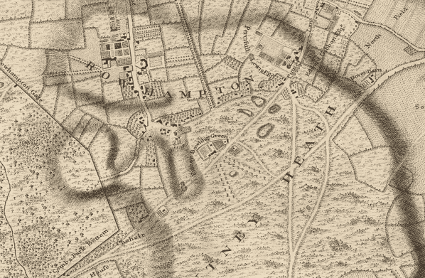
The historical significance of this route is captured in “Sheet X: An Exact Survey of the Cities of London and Westminster,” a survey of London from circa 1747 by John Rocque and Richard Parr 4. This map clearly illustrates the original path of the road long before modern development.
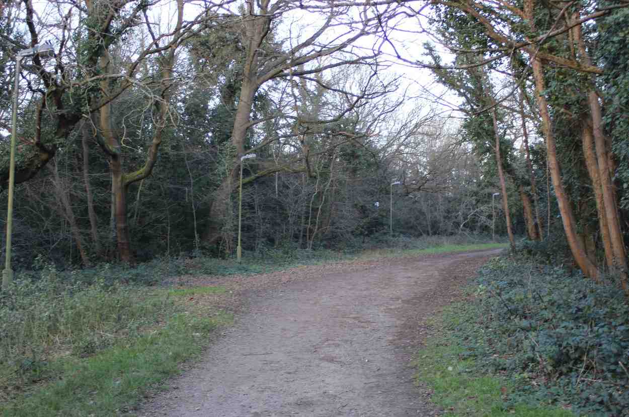
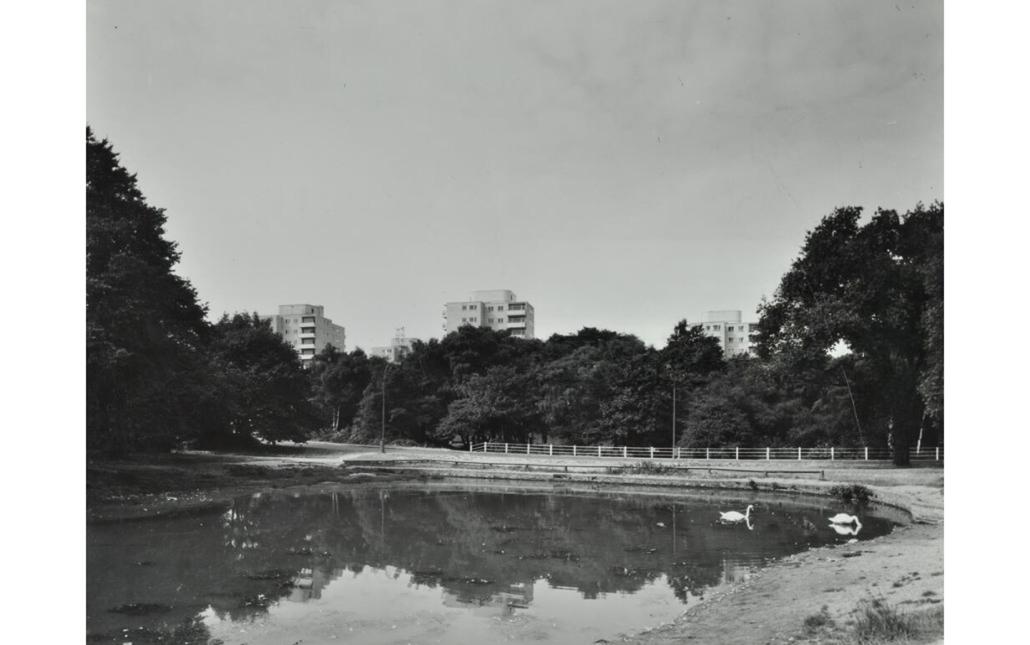
Evidence of the road’s original alignment can also be seen in the mid-20th-century image below, which shows the route curving gracefully around Scio Pond before it was eventually severed.
https://historicengland.org.uk/listing/the-list/list-entry/1065484?section=official-list-entry ↩︎
https://historicengland.org.uk/listing/the-list/list-entry/1357671?section=official-list-entry ↩︎
https://www.oldmapsonline.org/en/London_Borough_of_Wandsworth?gid=046cb827-7216-5d2b-84a2-e61e50092a69#position=12.2709/51.4608/-0.2016&year=1747 ↩︎